A quieter basemap
When Meta launched its multi-scale basemap at the end of 2020, it was meant to be a foundation: geographic features that apps layer their own data over. Facebook, Instagram and WhatsApp rely on it for status updates, location sharing and location-based search. Two years on, the underlying data model and the visual styling have both been overhauled, and the map now has to serve a wider range of surfaces and modes than the original release did.
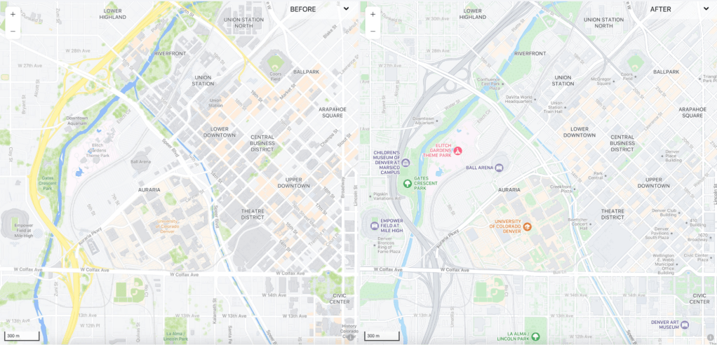
Color is a case in point. The launch palette was saturated enough that, on some screens, the map competed with the content drawn on top of it — a route from New York to LA, say, or a local pizza search on Instagram. The update pushes the basemap into the background with softer colors, which matters because landmark features overlap and interweave at multiple zoom levels. More than a few hex values had to change to keep every layer legible.
Roads have been visually deprioritized too. They remain in the map, but as connective tissue rather than the dominant element, so that community spaces and points of interest stand out. In selected cities, open-data pavement layers give high zooms a level of immediate visual clarity that a conventional road network does not provide.
Buildings reworked from the tags up
Building rendering was redone from the data layer upward. The tangled building and building:part tags in OpenStreetMap were parsed to produce a cleaner feature set. High-traffic areas get a "areas of interest" treatment — a creamy orange tint at mid zooms — which switches off at higher zooms in favor of a building highlight that keeps the background clean. Transportation buildings (airport terminals, parking garages, metro stations) are tinted bluish to echo the new icon layer.
Icons were not part of the original basemap because clients inserted their own contextual markers. As the number of use cases across Meta grew, that assumption stopped holding. The refresh introduces icons for parks, universities, and entertainment venues such as amusement parks and zoos, and redraws existing airport and rail icons to match the new theme.
Raster-first and dark-mode variants
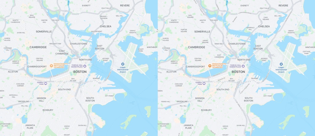
The basemap effort now serves several products rather than a single tileset. A dark-mode variant launched in fall 2021 to match the dark UI surfaces. In early 2022, raster-first basemaps arrived as a complement to the vector maps. Raster uses fixed pixels and renders subtle color gradations well but blurs on zoom; vector stores line and fill equations that scale cleanly. Mobile and web clients get both, because compressed rasters are lighter and run acceptably on older devices. The raster maps carry the same features as their vector counterparts but are designed specifically to be rasterized and delivered as a tiled service, so cartographic effects like opacity, blur and shadow are removed for crisp output. The two look near enough that most people would not notice which one they are seeing.
Data pipeline: Daylight, Earth Tables and next steps
All maps still consume Daylight, the curated distribution of OpenStreetMap data used to filter geometry errors, vandalism and profanity and to keep the map current. With the Daylight team at Meta, the company published Earth Tables, an extension that simplifies OSM tags into a schema sufficient to render a world map; it grew out of Meta’s own cartographic tiling logic. Details were presented at the annual NACIS conference.
Some regions now render AI-based translations for map labels, making street names readable to more people. Open data is also feeding new layers: select cities have high-resolution pavement data, tree positions and pavement markings. In 2023, Meta plans to incorporate data from the Overture Maps Foundation, which it co-founded with Microsoft, AWS and TomTom.
What’s next
The basemap team is exploring global land cover, terrain at multiple resolutions, and other additions. Work also continues with partners on open 3D geospatial data aimed at digital twins and metaverse applications; more is available at Maps at Meta.